4D-ID: A Shared Identity Layer for the Spatial World
This is the studio's original essay. The canonical 4D-ID version lives at 4d-id.org.
Four systems can look at the same warehouse door and call it four different things.
Robot:       track_47
XR runtime:  anchor_923
BIM:         GUID_882
3D scan:     segment_108
Each has its own coordinates, its own geometry, its own local ID. None of them can tell you it is the same door.
The hard question in spatial computing is not where is it. Localization already answers that. The hard question is:
Which persistent thing are we talking about?
4D-ID gives them a shared answer:
track_47
anchor_923
GUID_882      ──→   4did:...DOOR17
segment_108
Nobody gives up their own IDs. They gain a reference that lives outside all of them.
Identity is not perception
4D-ID does not replace computer vision, SLAM, VPS, segmentation, registration, or navigation. Those systems establish that a meaningful entity exists and where it sits. That step is grounding.
OBSERVE   →   GROUND   →   IDENTIFY   →   RESOLVE   →   INTEROPERATE
sensors,      detect,       4D-ID         lookup        robots, XR,
records       match      mints / links    by name       AI, twins
Grounding produces the evidence. 4D-ID defines what happens after: how the identity is represented, resolved, merged, split, and maintained over time.
A camera detection is an observation. A scan segment is a representation. A BIM GUID is an external identifier. A robot track is a hypothesis. None of them automatically becomes a persistent identity.
Identity persists. Coordinates do not.
Scan a building with XGRIDS this year, Matterport next year, remap it in XR, let a robot build its own map on entry. Six representations, six coordinate frames, one building.
2026 XGRIDS scan
2028 Matterport
2030 robot map      ──→   4did:...BUILDING72
BIM + city model
A rescan is a representation change, not an identity change. Neither is a remodel, a vendor swap, or a robot reloading its map. That stability is what lets you ask useful questions: What is the newest scan of this room? What did it look like two years ago? Which robot saw it last?
Why not just use a UUID?
A UUID makes an identifier unique. It does not tell two independent systems that their different UUIDs mean the same thing.
The problem is not generating another number. It is establishing and preserving A = B = C = D across vendors, sensors, and years. That takes aliases, relationships, representations, hierarchy, provenance, resolution, and a merge/split lifecycle.
The goal is not uniqueness. It is interoperable identity.
Four core concepts
Identity
A persistent reference to the entity itself, stable while observations, coordinates, representations, and state all change.
Hierarchy
Things live inside things: Earth → City → Facility → Floor → Room → Machine → Part. Move the parent and the children come along. No one re-describes ten thousand boxes when the ship sails.
Pose
Where the entity is and how it is oriented, relative to a declared frame. Pose is state attached to the identity, not the identity itself. Existing systems keep their own frames.
Time
Spatial state only means something with a timestamp. 4D-ID carries time-aware state, history, and provenance without the identifier ever changing.
You can start without AI
Most valuable entities are already named in structured systems: parcel numbers, BIM GUIDs, asset tags, device IDs, MLS records, container numbers, serial numbers. Those reconcile directly into persistent identities.
County parcel record
MLS property
BIM building        ──→   4did:...BUILDING72
XGRIDS + Matterport
Perception matters when you need to ground unstructured observations to those entities. It is not the entry fee.
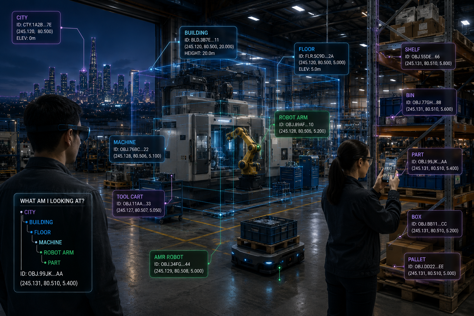
What it looks like deployed
Scans · Cameras · BIM · GIS · Asset Data
                 ↓
          GROUNDING LAYER
   detect · classify · track · match
                 ↓
       entity hypothesis + evidence
                 ↓
               4D-ID
    identity · aliases · lifecycle
       provenance · resolution
                 ↓
Robots · XR · AI · Maps · Digital Twins
The grounding layer can be native to a source system or supplied externally, for example by a Spatial Entity Grounding Service that ingests LiDAR, imagery, city models, robot frames, and asset databases and returns candidate entities with evidence.
Once the door is DOOR17, the robot navigates to it, the headset annotates it, the twin attaches maintenance history to it, and an agent can ask about it by name. Each system keeps its internal representation. They share an identity.
Why this matters now
Robots, autonomous vehicles, XR devices, digital twins, AI agents, and continuously updated reconstructions are all arriving at once, and all of them need to reference the same real places. Without a shared identity layer, every integration re-solves the same four questions by hand:
- Does your object mean the same thing as my object?
- Does this new scan represent the same building?
- Did this robot observation refer to the same machine?
- Does this XR anchor correspond to this BIM component?
4D-ID standardizes that layer instead of making every pair of systems invent it again.
Keep your own maps, coordinates, representations, and internal IDs. Share a persistent way to refer to the same thing.
Grounding makes the world understandable. 4D-ID makes that understanding persistent and interoperable.
4D-ID is a working candidate specification for persistent spatial identity, designed to complement existing standards rather than replace them. It has not yet been adopted by a standards body.
Read the 4D-ID Standard →