HikQR (“hiker”) - Trail Intelligence, Powered by WorldAgent
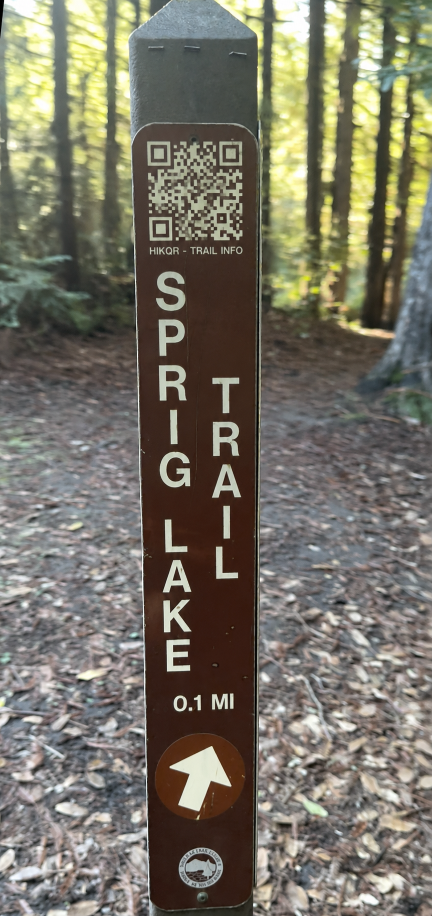
A QR code at the trailhead. Spatial LLM intelligence behind it.
Every trail app tells you the same thing: distance, elevation, a couple of photos from 2019. It doesn’t know the trail washed out last week. It doesn’t know your kid is four years old and this section is too steep. It doesn’t know that the locals and the visitors describe this place completely differently.
HikQR is built to know all of that. Scan a QR code at any trailhead and get real-time, cohort-sensitive trail intelligence, and location based social networks. (SO POWERFUL)..all powered by the WorldAgent spatial framework.
The Problem With Trail Information Today
Trail data is static. Someone hiked it once, rated it, wrote a description. That description lives forever, indifferent to season, weather, recent damage, who you are, or what you need. A 25-year-old trail runner and a family with a dog and a stroller get the same page. The information is technically correct and practically useless.
Park services do their best, but updates are manual, slow, and don't reach people where they're standing. By the time a trail closure makes it to a website, a hundred hikers have already turned back.
How HikQR Works
A hiker arrives at a trailhead and scans a QR code. That's it. No app download. No account required.
Behind the scan, WorldAgent's spatial intelligence service activates. Every trail in the area has its own agent - a persistent, living representation that knows what's happening on that trail right now. The system answers the questions that actually matter:
Look at the screenshot. The Sprig Lake / Blackhawk Loop is tagged CONTESTED - because families with young kids split 55/45 on whether it's approachable. That's not a bug. That's the system being honest about something every other trail app papers over with a single star rating.
Trust Scores, Not Star Ratings
Every piece of information in HikQR carries four trust dimensions:
- AUT (Authority) - Does the source have standing? A park ranger's trail report scores higher than an anonymous tip.
- REP (Reputation) - Has this source been reliable over time?
- COR (Corroboration) - Do other independent sources agree?
- REC (Recency) - How fresh is this? A report from two hours ago beats one from two months ago.
In the screenshot, the trail condition report scores 0.95 authority, 0.90 reputation, 0.85 corroboration, 0.98 recency. Reported by a ranger, observed two hours ago. You can see exactly why the system believes what it tells you.
This is what WorldAgent's "report belief, not truth" principle looks like in production. No black boxes. No mystery algorithms. Lineage you can inspect.
WorldAgent in Action
HikQR is a proof of concept for something much bigger than hiking. It demonstrates the core WorldAgent pattern:
- Nested agents. Every trail has its own agent. So does the park, the region, and the area around the hiker. They talk to each other. Local detail with regional awareness.
- Cohort conditioning. The same trail, described differently for different people. Not personalization theater - genuine differences in what matters.
- Contestation as a feature. When people disagree about a place, the system doesn't pick a winner. It shows you the disagreement and lets you decide.
- Transparent provenance. Every claim traces back to a source, a timestamp, and a confidence score. Trust is earned, not asserted.
This same pattern - agents for places, cohort-sensitive answers, trust-scored intelligence - is what powers every WorldAgent application, from HearHere audio guides to QuantumEvents show navigation. HikQR just makes the architecture visible.
The QR Code Is the Interface
No app store. No download. No friction. A weatherproof QR code at the trailhead connects hikers to a living spatial intelligence layer that knows their trail, their conditions, and their context.
Parks and land managers can deploy HikQR with zero infrastructure - just print and post. The intelligence lives in the WorldAgent network. The QR code is just the door.
Don't see your trail? HikQR lets anyone request coverage for a trail or area. The system routes it to maintainers and the signals network expands. Every request makes every nearby trail smarter.
What the hiker actually sees.
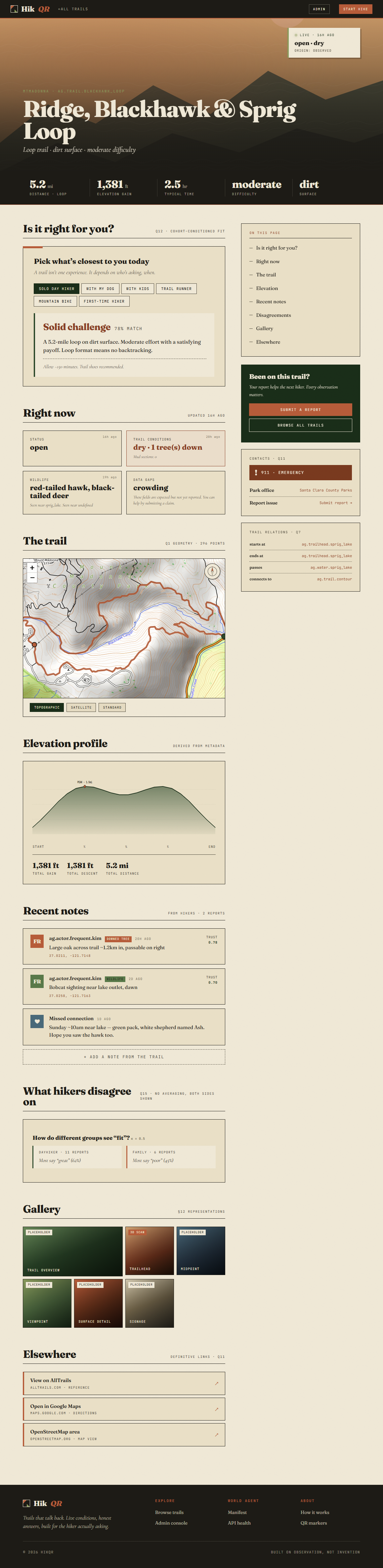
One scan. No app. The full trail page loads instantly - real-time conditions, fit-for-cohort analysis, elevation profile, recent notes from other hikers, a gallery tagged by what matters (surface detail, viewpoint, trailhead), and links out to AllTrails, Google Maps, and OpenStreetMap.
This is what "spatial intelligence at the point of need" looks like in practice. Everything on this page is generated, scored, and kept current by the trail's own WorldAgent.
Trails are just the beginning. Location Based QR Codes are the secret weapon. Any physical space that people visit, experience, and describe differently is a candidate for this pattern. WorldAgent provides the spatial intelligence. HikQR proves it works where the signal is weakest and the stakes are real - on the trail, in the moment, for the person standing there.